

Exploration

3D geological models
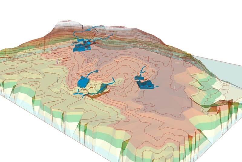
Computer graphics currently enable mathematical representation of any three-dimensional surface of an object.
The 3D geological models are a graphical approximation of the geometry of mineralized bodies, being essential to the development of the drilling and sampling plan, for the evaluation of resources and reserves, and to the development of the mining project. In the exploitation phase three-dimensional geological modeling allows accurate calculation of reserves, given different exploitation scenarios.
This technique requires the acquisition and interpretation of base data on the field, and the use of specific software (AutoCAD, ArcGIS, Surpac), being an instrument increasingly used in all stages of development of the mining project.
VISA Consultores has extensive experience in geological three-dimensional modeling, providing the technical and human resources required for its realization.
VISA Portugal
Rua A Gazeta de Oeiras, 18-A,
2780-171 Oeiras,
Portugal
Contacts
Telephone
(+351) 214 461 420
Mobile Phone
(+351) 962 503 650
Fax
(+351) 214 461 421
General
geral@visaconsultores.com
Comercial
comercial@visaconsultores.com
Contact Us


